Jeppesen introduces new C-MAP MAX-N Local charts to North American boaters
- Details
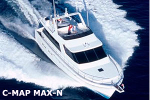 ENGLEWOOD, Colo. -- Today's 2013 Fort Lauderdale International Boat Show presented the ideal venue for Jeppesen to introduce new C-MAP MAX-N Local charts to North American boaters. The availability of MAX-N Local cartography is important news for the many owners of popular Lowrance Elite 7 and HDS Gen1, Gen2 and Gen2Touch, Simrad NSS, NSE and NSO, and B&G Zeus Touch Multifunction Navigators.
MAX-N Local charts deliver the trusted Jeppesen chart detail and information boaters need to explore their favorite fishing, diving and cruising spots — at a cost that won't put a dent in today's boating budget. While called "Local" charts, these new MAX-N chart titles provide far-ranging coverage that will meet all the fishing and cruising needs of the majority of boaters.
MAX-N Local charts feature up-to-date data from official sources, with detailed presentation of Depth Areas and Contours, Spot Soundings, NavAids, Light Sectors, Wreck/Obstructions, Anchorage Areas, Small Craft Facilities and more. These advanced charts also provided clearly marked boundaries for Restricted, Caution, Fishing and Prohibited Areas (including California's expanding network of Marine Protected Areas) for the region, helping boaters and fishermen stay out of danger and on the right side of local regulations.
Jeppesen's MAX-N Local charts are available immediately on pre-programmed micro SD cards (with adapter) through Jeppesen dealers or online via Jeppesen Direct. In the near future, MAX-N Local charts will also be available for download directly through the Navico Insight Store (InsightStore.Navico.com).
The purchase of MAX-N Local charts is more than a great deal today; it's a great investment that will continue to improve and offer boaters an even better navigation experience in the future. Navigators who get "onboard" now with MAX-N charts will have easy access to a variety of new, professional-grade features on the horizon.
To learn more about Jeppesen MAX-N Local cartography for popular Lowrance, Simrad and B&G navigation systems, visit your authorized C-MAP by Jeppesen dealer or visit online at www.jeppesen.com/marine/MAX-N.
About Jeppesen
Jeppesen is a market-leading provider of vessel operations services and digital navigation solutions, based on worldwide vector chart data type approved to ISO19879, meteorological information and transmission technologies. Jeppesen offers a wide range of navigation and operations products and services to both recreational and commercial marine markets. Safety-conscious boaters and operators of vessels ranging from coastal to SOLAS class, rely on Jeppesen for innovative navigation solutions that improve safety and efficiency.
Business Directory
![]()
Click Here to Claim or Submit Your Business Listings for Free!


